So, another month and another map for the
Atlas Elyden is finished.
The City-kingdoms of the Haréshk are relics of an ancient feudal system, and though that system of governance was consigned to history long ago, foreigners still know the Haréshk for its feudal lords, heraldry, classical literature and knights.
The truth is the region is on the cusp of industrialization, and looks to the West and the Korachani empire with impressionable eyes. Trade with more advanced nations is on the rise, bringing City-kingdoms in contact with Tamar, Khamid, Malan, Saua and Ahrishen, like never before. Even Lydiria, known for its xenophobia, has established trade with the City-kingdoms, bringing a wealth of resources, goods and information into the region. Factories are beginning to appear on a scale as yet unseen outside of Korachan, and wealth is finally moving from the descendants of the ancient feudal families to upstart merchant lords, business owners and magnates.
Unlike other pats of the world, which are variously afflicted by the world's waning, the Haréshk is an idyllic realm of rugged fields, rocky escarpments and clear water, something that the voracious empire of Korachan is not ignoring...
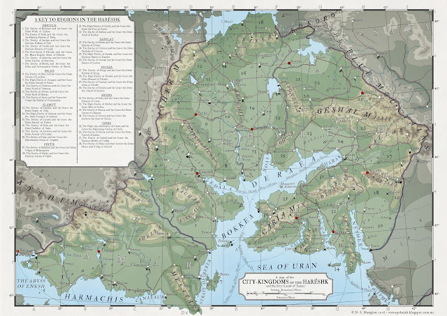 |
| the City-kingdoms of the Haréshk |
Work begins on the Republic of Almagest, a large region autonomous from the Korachani empire. As the region is somewhat north of the Inner Sea, I;ve had to start work on its topography from scratch, which is taking some time. I was considering dividing the map in two - having the north-east in one two-page spread and the south-west on another two-page spread - since its a large country, though I'm not sure on how 'nice' that will look, and how easily the transition between pages can be accomplished. Well, it's not something I need to worry about until the topography is complete, speaking of which:
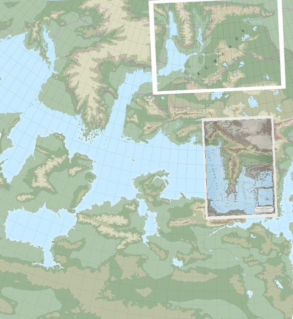 |
| WIP topography |
This is a partial stitch of 3 base maps I'm using when working on the topographies (most of the areas in the above map have only partial topographies, apart from the finished regions, of course). This is here to show how small each atlas entry really is - see the finished Korachani overlay on the lower right and compare it with the Almagesti territories in the top left. Quite a difference, keeping in mind both of those white frames are meant to be A3 in size!
Almagest is actually 3 separate parts of the map - the mainland and 2 'colonies' in the headland to the west and again farther west across the sea. There are also colonies that are farther away, similar to the inset maps in the Korachan map, and if I have enough room on the main map i'll include them too. All will be revealed soon!
***
#Atlaselyden, #Fantasyatlas, #theharéshk, #Tamar, #Encyclopaediaelyden,


